Tuesday, January 30, 2018

Airbus selected by ESA for EGNOS V3 program

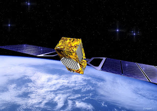
Airbus has been selected by the European Space Agency (ESA) as the prime contractor to develop EGNOS V3, the next generation of the European Satellite Based Augmentation System (SBAS) planned to provide the aviation community with advanced Safety of Life services and new services to Maritime and Land users. Developed by ESA on behalf of the European Commission and the European GNSS Agency (GSA), EGNOS V3 (European Geostationary Navigation Overlay Service) will provide augmented operational Safety of Life services over Europe that improve the accuracy and availability of user positioning services from existing Global Navigation Satellite Systems (Galileo and GPS) and provides crucial integrity messages to EGNOS users with alerts within a few seconds in case of system degradation, consolidating EGNOS' position as one of the leading edge GNSS Systems in the future. EGNOS V3 will thus offer improved Safety of Life (SoL) services performances (where people's lives are potentially at stake) over Europe to Civil Aviation community and new applications for Maritime or Land users, and will improve robustness against increasing security risks, in particular cyber-security risks.


EGNOS V3 will ensure a full continuity of service for the next decade and will be the first operational SBAS implementing the dual frequency and multi constellation world standard, with both GPS and Galileo, replacing EGNOS V2 which has been in operation since 2011.

"This programme is strategic for Airbus to strengthen our position in the Navigation field. The signature of this contract is the result of more than 5 years of intense team work and investment," said Nicolas Chamussy, Head of Space Systems at Airbus.

"With our Consortium, we bring a large pool of resources and experience in Europe covering the successful development of critical and secure ground segment. I am confident that we will make EGNOS V3 a success story."

As Prime contractor, Airbus will be leading a consortium with partners from France, Germany, Spain and Switzerland. Airbus will be responsible for the development, integration, deployment and preparation of EGNOS V3 operations, the overall performance of the system and the Central Processing Facility which is the heart of the real time navigation algorithms.

During the 6.5 year contract, around 100 people and 20 subcontractors will work on delivering the EGNOS V3 system. In 2023, the single frequency version will be available to replace the current operational version and, 18 months later, the final version in dual frequency will be delivered.

EGNOS is composed of a large network of about 50 ground stations deployed over Europe, Africa and North America, two master control centres located near Rome and Madrid, and a System Operation Support Centre in Toulouse. EGNOS will also use geostationary satellites navigation payload.

Monday, January 29, 2018

SpaceX CEO Sets Date for First Falcon Heavy Rocket Launch

The first flight of Falcon Heavy, the powerful rocket manufactured by the US Space Exploration Technologies (SpaceX) company, is planned for February 6, the company's founder and CEO Elon Musk said on Sunday. "Aiming for first flight of Falcon Heavy on Feb 6 from Apollo launchpad 39A at Cape Kennedy," Musk wrote on Twitter. On Thursday, SpaceX fired up all 27 engines on the rocket in its final test. Falcon Heavy is said by SpaceX to be the most powerful operational rocket, able to deliver 54 metric tons (approximately 119,000 pounds) of cargo to orbit.


The first stage of the rocket is composed of three Falcon 9 cores and is said to be capable of delivering payload at one-third of the cost the manufactured by SpaceX rival United Launch Alliance Delta IV Heavy does.

Sunday, January 28, 2018

Astronomers produce first detailed images of surface of giant star

An international team of astronomers has produced the first detailed images of the surface of a giant star outside our solar system, revealing a nearly circular, dust-free atmosphere with complex areas of moving material, known as convection cells or granules, according to a recent study.The giant star, named p1Gruis, is one of the stars in the constellation Grus (Latin for the crane, a type of bird), which can be observed in the southern hemisphere. An evolved star in the last major phase of life, p1Gruis is 350 times larger than the Sun and resembles what our Sun will become at the end of its life in five billion years. Studying this star gives scientists insight about the future activity, characteristics and appearance of the Sun. Convection, the transfer of heat due to the bulk movement of molecules within gases and liquids, plays a major role in astrophysical processes, such as energy transport, pulsation and winds.The Sun has about two million convective cells that are typically 2,000 kilometers across, but theorists believe giant and supergiant stars should only have a few large convective cells because of their low surface gravity. Determining the convection properties of most evolved and supergiant stars, such as the size of granules, has been challenging because their surfaces are frequently obscured by dust.


In this study, the researchers discovered the surface of the giant star p1Gruis had a complex convective pattern and the typical granule measured 1.2 x 10^11 meters horizontally or 27 percent of the diameter of the star. The findings are published in the journal Nature.

"This is the first time that we have such a giant star that is unambiguously imaged with that level of details," said Dr. Fabien Baron, assistant professor in the Department of Physics and Astronomy at Georgia State University.

"The reason is there's a limit to the details we can see based on the size of the telescope used for the observations. For this paper, we used an interferometer. The light from several telescopes is combined to overcome the limit of each telescope, thus achieving a resolution equivalent to that of a much larger telescope."

The star p1Gruis was observed with the PIONIER instrument, which has four combined telescopes, in Chile in September 2014. Baron, who specializes in making images, used interferometric data, image reconstruction software and algorithms to compose images of the star's surface.

Interferometry is relatively new to astronomy, and Georgia State's Center for High Angular Resolution Astronomy array was the first facility to use interferometry to image a star similar to the Sun in 2007.

This study was also the first to confirm theories about the characteristics of granules on giant stars.

"These images are important because the size and number of granules on the surface actually fit very well with models that predict what we should be seeing," Baron said.

"That tells us that our models of stars are not far from reality. We're probably on the right track to understand these kinds of stars."

The detailed images also showed different colors on the star's surface, which correspond to varying temperatures. A star doesn't have the same surface temperature throughout, and its surface provides our only clues to understand its internals. As temperatures rise and fall, the hotter, more fluid areas become brighter colors (such as white) and the cooler, more dense areas become darker colors (such as red).

In the future, the researchers would like to make even more detailed images of the surface of giant stars and follow the evolution of these granules continuously, instead of only getting snapshot images.

Saturday, January 27, 2018

Ariane 5 satellites in orbit but not in right location yet

Two commercial satellites have been placed in orbit by an Ariane 5 rocket but have yet to reach their correct position, Arianespace said Thursday, after mission control briefly lost contact with the craft in a rare malfunction.The usually reliable European space workhorse blasted off at 7.20 pm (2220 GMT) from the Kourou Space Centre in French Guiana carrying satellites for Luxembourg's SES and the United Arab Emirate's Yahsat in the first launch of the year for Arianespace. For nearly 30 minutes mission controllers were left on tenterhooks when the rocket lost contact in what CEO Stephane Israel described as an "anomaly". But the team later received good news when the satellites chirped back into radio contact. "Both satellites were confirmed separated, acquired and they are on orbit," Arianespace said in an updated statement after the initial lift-off scare. The French-headquartered company said a tracking station in Brazil was unable to locate the craft shortly after ignition of the rocket's upper stage. "This lack of telemetry lasted throughout the rest of powered flight," the statement said. But both satellites were later "communicating with their respective control centres". But a source told AFP the satellites did not detach from the rocket in the correct place after the craft followed an "imperfect trajectory".


Arianespace said they were currently "repositioning the satellites in the right place using their propulsion systems" adding that their current status was "reassuring after strong concerns".

Israel had earlier tweeted that the initial launch had been "flawless".

- Reliable workhorse -

The SES satellite, built by Airbus in the UK, weighs more than four tonnes and is carrying both telecoms equipment as well as a NASA platform designed to explore the boundary between Earth's atmosphere and space.

Yahat's Al-Yah 3 satellite weighs in at 3,795 kilogrammes and also carries telecommunications equipment.

Since it was founded in 1980, Arianespace has put more than 550 satellites into orbit including for Europe's Galileo GPS system. The company posted sales of approximately 1.3 billion euros ($1.6 billion) in 2017.

The Galileo programme, when complete, will have 30 satellites in three orbital planes by 2020.

If all goes according to plan the system will be able to pinpoint a location on Earth to within a metre -- compared to several metres for the United States' GPS and the Russian GLONASS systems.

First used in 1986, the Ariane 5 vehicle has a strong track record of reliability although the company faces stiff competition from Elon Musk's SpaceX.

Two recent launches have suffered malfunctions but were shut down before the rocket could lift off.

In September mission control aborted the launch of an Ariane 5 rocket carrying two commercial satellites in the final countdown as the main engine was being ignited.

An Ariane 5 lift-off was also aborted at main engine ignition in March 2011.

The Kourou Space Centre has also been hit by strikes. Last year workers in the French territory erected barricades around the space centre and delayed the launch of a rocket several times.

Guiana, home to some 250,000 people, has been administered as a French region since the end of the 18th century.

Thursday, January 25, 2018

A new 'atmospheric disequilibrium' could help detect life on other planets

As NASA's James Webb Space Telescope and other new giant telescopes come online they will need novel strategies to look for evidence of life on other planets. A University of Washington study has found a simple approach to look for life that might be more promising than just looking for oxygen. The paper, published Jan. 24 in Science Advances, offers a new recipe for providing evidence that a distant planet harbors life. "This idea of looking for atmospheric oxygen as a biosignature has been around for a long time. And it's a good strategy - it's very hard to make much oxygen without life," said corresponding author Joshua Krissansen-Totton, a UW doctoral student in Earth and space sciences."But we don't want to put all our eggs in one basket. Even if life is common in the cosmos, we have no idea if it will be life that makes oxygen. The biochemistry of oxygen production is very complex and could be quite rare." The new study looks at the history of life on Earth, the one inhabited planet we know of, to find times where the planet's atmosphere contained a mixture of gases that are out of equilibrium and could exist only in the presence of living organisms - anything from pond scum to giant redwoods. In fact, life's ability to make large amounts of oxygen has only occurred in the past one-eighth of Earth's history.


By taking a longer view, the researchers identified a new combination of gases that would provide evidence of life: methane plus carbon dioxide, minus carbon monoxide.

"We need to look for fairly abundant methane and carbon dioxide on a world that has liquid water at its surface, and find an absence of carbon monoxide," said co-author David Catling, a UW professor of Earth and space sciences.

"Our study shows that this combination would be a compelling sign of life. What's exciting is that our suggestion is doable, and may lead to the historic discovery of an extraterrestrial biosphere in the not-too-distant future."

The paper looks at all the ways that a planet could produce methane - from asteroid impacts, outgassing from the planet's interior, reactions of rocks and water - and finds that it would be hard to produce a lot of methane on a rocky, Earth-like planet without any living organisms.

If methane and carbon dioxide are detected together, especially without carbon monoxide, that's a chemical imbalance that signals life. The carbon atoms in the two molecules represent opposite levels of oxidation. Carbon dioxide holds as many oxygen molecules as it can, while the carbon in methane lacks oxygen and instead has oxygen's chemical adversary, hydrogen.

"So you've got these extreme levels of oxidation. And it's hard to do that through non-biological processes without also producing carbon monoxide, which is intermediate," Krissansen-Totton said.

"For example, planets with volcanoes that belch out carbon dioxide and methane will also tend to belch out carbon monoxide."

What's more, carbon monoxide tends not to build up in the atmosphere of a planet that harbors life.

"Carbon monoxide is a gas that would be readily eaten by microbes," Krissansen-Totton said.

"So if carbon monoxide were abundant, that would be a clue that perhaps you're looking at a planet that doesn't have biology."

The authors agree that oxygen is a good way to look for signs of life, but think that this new combination is at least as likely to pop up through the new telescopes' sights.

"Life that makes methane uses a simple metabolism, is ubiquitous, and has been around through much of Earth's history," Krissansen-Totton said.

"It's an easy thing to do so it's potentially more common than oxygen-producing life. This is definitely something we should be looking for as new telescopes come online."

Tuesday, January 23, 2018

Real-world intercontinental quantum communications enabled by the Micius satellite

Private and secure communications are fundamental human needs. In particular, with the exponential growth of Internet use and e-commerce, it is of paramount importance to establish a secure network with global protection of data. Traditional public key cryptography usually relies on the computational intractability of certain mathematical functions. In contrast, quantum key distribution (QKD) uses individual light quanta (single photons) in quantum superposition states to guarantee unconditional security between distant parties. Previously, the quantum communication distance had been limited to a few hundred kilometers, due to the optical channel losses of fibers or terrestrial free space. A promising solution to this problem exploits satellite and space-based link, which can conveniently connect two remote points on the Earth with greatly reduced channel loss because most of the photons' propagation path is in empty space with negligible loss and decoherence. A cross-disciplinary multi-institutional team of scientists from the Chinese Academy of Sciences, led by Professor Jian-Wei Pan, has spent more than ten years developing a sophisticated satellite, Micius, dedicated to quantum science experiments, which was launched on August 2016 and orbits at an altitude of ~500 km. Five ground stations are built in China to cooperate with the Micius satellite, located in Xinglong (near Beijing), Nanshan (near Urumqi), Delingha (37 degrees 22'44.43''N, 97 degrees 43'37.01"E), Lijiang (26 degrees 41'38.15''N, 100 degrees 1'45.55''E), and Ngari in Tibet (32 degrees 19'30.07''N, 80 degrees 1'34.18''E).


Within a year after the launch, three key milestones for a global-scale quantum internet have been achieved: satellite-to-ground decoy-state QKD with kHz rate over a distance of ~1200 km (Liao et al. 2017, Nature 549, 43); satellite-based entanglement distribution to two locations on the Earth separated by ~1200 km and Bell test (Yin et al. 2017, Science 356, 1140), and ground-to-satellite quantum teleportation (Ren et al. 2017, Nature 549, 70). The effective link efficiencies in the satellite-based QKD were measured to be ~20 orders of magnitudes larger than direct transmission through optical fibers at the same length of 1200 km. The three experiments are the first steps towards a global space-based quantum internet.

The satellite-based QKD has now been combined with metropolitan quantum networks, in which fibers are used to efficiently and conveniently connect numerous users inside a city over a distance scale of ~100 km. For example, the Xinglong station has now been connected to the metropolitan multi-node quantum network in Beijing via optical fibers.

Very recently, the largest fiber-based quantum communication backbone has been built in China, also by Professor Pan's team, linking Beijing to Shanghai (going through Jinan and Hefei, and 32 trustful relays) with a fiber length of 2000 km. The backbone is being tested for real-world applications by government, banks, securities and insurance companies.

The Micius satellite can be further exploited as a trustful relay to conveniently connect any two points on Earth for high-security key exchange. To further demonstrate the Micius satellite as a robust platform for quantum key distribution with different ground stations on Earth, QKD from the Micius satellite to Graz ground station near Vienna has also been performed successfully this June in collaboration with Professor Anton Zeilinger of Austrian Academy of Sciences.

The satellite thus establishes a secure key between itself and, say, Xinglong, and another key between itself and, say, Graz. Then, upon request from the ground command stations, Micius acts as a trusted relay.

It performs bitwise exclusive OR operations between the two keys and relays the result to one of the ground stations. That way, a secret key is created between China and Europe at locations separated by 7600 km on Earth. This work points towards an efficient solution for an ultra-long-distance global quantum network.

A picture of Micius (with a size of 5.34 kB) was transmitted from Beijing to Vienna, and a picture of Schrodinger (with a size of 4.9 kB) from Vienna to Beijing, using approximately 80 kbit secure quantum key for one-time-pad encoding.

An intercontinental videoconference was also held between the Chinese Academy of Sciences and the Austria Academy of Sciences, employing the Advanced Encryption Standard (AES)-128 protocol that refreshed the 128-bit seed keys every second. The videoconference lasted for 75 min with a total data transmission of ~2 GB, which included ?560 kbit of the quantum key exchanged between Austria and China.

Monday, January 22, 2018

Rocket Lab successfully sends rocket into orbit

Aerospace company Rocket Lab said Sunday it had successfully fired a rocket into orbit for the first time from its New Zealand launch base. "Electron is orbital. Successful payload deployment," the company tweeted. The Electron rocket, named "Still Testing", took off from Mahia, on the east coast of the North Island, at 2.45pm (0145 GMT) on Sunday and reached orbit eight minutes later. The 17-metre-long (55ft 7in) carbon-fibre rocket is carrying three satellites into space -- one to take images of Earth for United States company Planet Labs, and two to capture weather and ship tracking data for Spire Global. "Speechless. Just like that, @rocketlab reaches orbit and sets a new bar for launch by reaching orbit on just their 2nd test," satellite-powered data company Spire tweeted. Rocket Lab conducted its first launch last May when the firm put a rocket into space, but it did not reach orbit.


Although New Zealand-founded, Rocket Lab lists itself as an American company with headquarters at a wholly-owned New Zealand subsidiary.

Backers include US companies Khosla Ventures, Bessemer Venture Partners, Lockheed Martin, Promus Ventures and Data Collective.

The company says its mission is to provide "frequent launch opportunities to low Earth orbit" with a range of rocket systems and technologies "for fast and affordable payload deployment".

Rocket Lab launch services with Electron are reported to cost US$4.9 million per flight.

Saturday, January 20, 2018

JAXA testing engine for next-generation rocket

Japan's space agency is developing the main engine for its next-generation H-III rocket, which could see service in fiscal 2020. The H-III will be key to Japan expanding its presence in the global satellite launch market, which has been dominated by the U.S., Europe and Russia. This marks the first time in about 20 years that Japan has been developing main rocket engines. The Japan Aerospace Exploration Agency, or JAXA, began the first round of firing tests for the LE-9 engine on the southern island of Tanegashima in late April. A total of 11 ground tests are scheduled through June to check performance and durability. The LE-9 is a liquid cryogenic rocket engine burning liquid hydrogen and liquid oxygen in an expander bleed cycle. After completing another round of firing tests in fiscal 2018 starting next April, developers will construct the actual engine that will be installed in the H-III. The H-III will succeed the country's current H-series rockets, H-IIA and H-IIB. The H-III is designed to use three LE-9 engines when configured without strap-on solid rocket boosters, and two LE-9 engines when configured with them. The rocket is designed to launch with zero, two or four strap-on boosters, allowing it to deliver between two and seven metric tons to geostationary transfer orbit. IHI Aerospace, manufacturer of Japan’s Epsilon small launcher, is MHI’s supplier for the strap-on boosters for the H-2A and future H3. Kawasaki Heavy Industries provides the payload fairings.


The rocket will use commercially available components and a fuselage that can be mass produced, lowering launch costs to about half of the current price tag of approximately 10 billion yen ($88.6 million). The new, more powerful engine will allow the H-III to carry a midsize to large satellite weighing up to 6.5 tons -- 60% more than the H-IIA.


JAXA is working with the country's leading heavy machinery makers, such as Mitsubishi Heavy Industries and IHI, on rocket development. The total cost will likely reach about 190 billion yen.

With the powerful engine and lower launch costs, the government and space agency hope that the new rocket will garner more orders for satellite launches. They expect to send an average of about six H-IIIs into space from the Tanegshima Space Center every year.

Meanwhile, other countries are also working to roll out new rockets by around 2020. Russia currently launches on average some 30 rockets every year, while the U.S. sends up about 20 and China approximately a dozen. Japan launches only about three per year.

Unlike its competitors, Japan lacks launch centers. This puts it at a disadvantage as a work delay could affect the entire launch schedule of a satellite project. To compete with other countries, Japan has to improve its launch environment, including the capability for more frequent launches, and expand rocket development.

Thursday, January 18, 2018

Japan’s ASNARO-2 launched on third Epsilon flight

Japan’s experimental radar imaging satellite ASNARO-2 was launched Thursday aboard the third flight of the Epsilon rocket. Liftoff – from the Uchinoura Space Centre – occurred at the opening of a twenty-four-minute, two-second window opening at 06:06:11 local time (21:06 UTC on Wednesday). Japan’s first launch of 2018, Wednesday’s mission was originally scheduled towards the end of last year, before an electrical issue with the rocket delayed its liftoff. Epsilon was tasked with deploying the ASNARO-2 satellite into a sun-synchronous low Earth orbit. Advanced Satellite with New System Architecture for Observation 2 – or ASNARO-2 – is the second in a series of experimental Earth imaging satellites operated by Japan Space Systems, formerly the Institute for Unmanned Space Experiment Free Flyer (USEF). A radar imaging mission, it follows the ASNARO-1 optical satellite that launched aboard Russia’s Dnepr rocket in November 2014. The mission is funded by Japan’s Ministry of Economy, Trade and Industry through its New Energy and Industrial Technology Development Organisation (NEDO).

ASNARO-2 was constructed by NEC, and is based on the modular NEXTAR NX-300L platform. It measures 3.9 meters (12.8 feet) in length and 1.5 meters (4.9 feet) in height and width, excluding its solar panels and radar antenna. The satellite has a mass of 570 kilograms (1,257 lb) – including its 220-kilogram (485 lb) payload and 45 kilograms (99 lb) of propellant.


Two deployable solar arrays will generate electrical power for the satellite. At the end of the spacecraft’s five-year design life, these are still expected to be generating at least 1,300 watts of power.

ASNARO-2 will be operated in a near-circular sun-synchronous orbit, at an altitude of 505 kilometers (314 miles, 273 nautical miles) and an inclination of 97.4 degrees. It will orbit the Earth about once every 95 minutes.

The spacecraft carries XSAR, a synthetic aperture radar (SAR) payload operating in the X band. This can be operated in three different observation modes: spotlight, strip mapping and scanning.

The spotlight mode, where the instrument focusses on a small area of the Earth’s surface, offers the highest resolution – one meter (3 feet) or better – with a swath width of 10 kilometers (6.2 miles, 5.4 nautical miles). In strip mapping mode, the satellite can image a longer strip of the Earth’s surface in the direction of travel.


This offers a resolution of better than 2 meters (7 feet) over a swath width of 12 kilometers (7.5 miles, 6.5 nautical miles). Scanning mode allows the satellite to image a wider area – with a swath width of at least 50 kilometers (31 miles, 27 nautical miles) – at a resolution of at least 16 meters (52 feet).

Japan’s Epsilon rocket will undertake the ASNARO-2 launch. Epsilon, which made its debut in September 2013 with the Hisaki – formerly SPRINT-A – satellite. In its standard configuration, Epsilon is a three-stage all-solid rocket, however it can also fly with an optional liquid-fuelled fourth stage. Thursday’s launch – designated Epsilon-3 – will use this four-stage configuration.


JAXA developed Epsilon to provide Japan a rocket capable of placing small satellites into orbit. It draws heavily on pre-existing components, with its first stage based on the SRB-A3 boosters used by the larger H-IIA rocket, and its upper stages derived from the older M-V vehicle. M-V, which Epsilon replaced, was retired in 2006 as its high cost-to-payload ratio made it uneconomical to operate.

During the gap between the M-V’s retirement and Epsilon’s introduction, JAXA relied on foreign rockets such as Dnepr to launch its small satellites.

The Epsilon launches from the same launch complex at the Uchinoura Space Centre that was used by the M-V – and earlier members of the Mu family of rockets. The Uchinoura Space Centre is one of Japan’s two operational orbital launch sites. The facility was originally used by Japan’s Institute for Space and Astronautical Science, or ISAS, one of three Japanese space agencies that merged in 2003 to form JAXA.

Before the merger, ISAS operated Japan’s smaller rockets – Mu, Lambda and the country’s sounding rockets – while the National Space Development Agency (NASDA) flew larger liquid-fuelled rockets from the Tanegashima Space Centre. While operated by ISAS, what is now Uchinoura was named the Kagoshima Space Centre.

The Mu rockets were rail-launched, so Uchinoura’s Mu Centre launch complex was originally designed as a rail launcher. Now that the complex is used by the vertically-launched Epsilon, it has been modified and the former launch rail now serves as an umbilical tower.

Although it is Epsilon’s third flight, Thursday’s launch was the first to combine both the operational version of the rocket and the CLPS upper stage. The operational form of Epsilon, described by JAXA as “Enhanced Epsilon” at the time of its last launch – although this name seems to have been dropped – incorporates enhanced second and third stages over the original design that flew the vehicle’s maiden flight. The second Epsilon used this “Enhanced” configuration, which is now the standard for all launches, while the CLPS was used on the first Epsilon launch.

Thursday’s launch began with ignition of Epsilon’s SRB-A3 first stage at the zero mark in the countdown. Epsilon lifted off and climbed quickly away from Uchinoura. The SRB-A3 burned for 108 seconds, propelling the rocket to a speed of 2.3 kilometers per second (1.4 miles per second). Following first stage burnout, the mission entered a brief coast phase as the vehicle continues to ascend.


Two minutes and 31 seconds into the flight, Epsilon was in space at an altitude of about 123 kilometers (76 miles, 66 nautical miles). The payload fairing, which will have protected ASNARO-2 during its ascent through the atmosphere, was no longer be needed and was jettisoned to save weight. Ten seconds later, the spent first stage separated.

Epsilon’s second stage, M-35, ignited four seconds after first stage separation. Producing 445 kilonewtons (100,000 pounds) of thrust, the stage burned for two minutes and nine seconds. The second stage separated 96 seconds after ending its burn and the KM-V2c third stage ignited four seconds later.

The third stage burn lasted 88 seconds. Separation occurred one minute and 52 seconds after burnout, with the fourth stage – the Compact Liquid Propulsion System (CLPS) – igniting after another four minutes and 37 seconds. CLPS uses hydrazine propellant. It made two burns during Thursday’s launch, with the first lasting five minutes and 16 seconds.


Once the upper stage’s first burn has concluded, the vehicle coasted for 23 minutes and 17 seconds before the second burn began. This was a seven-minute, seven-second firing of the CLPS to place ASNARO-2 close to its operational orbit.

Spacecraft separation occurred two minutes and 24 seconds after the end of the second burn, at 52 minutes, 35 seconds mission elapsed time. At separation, Epsilon was at an altitude of 513 kilometers (319 miles, 277 nautical miles).

Thursday’s launch was Japan’s first of 2018. In 2017 the country made seven orbital launches – the most it has achieved in a calendar year. Japan’s next scheduled launch is expected to be a reflight of last January’s attempt to place a CubeSat into orbit using a modified SS-520 sounding rocket. This launch was delayed from December, and is awaiting confirmation of a new launch date once Epsilon lifts off.

After the SS-520 launch, Japan’s next mission will then be an H-IIA flight at the end of February, which is expected to deploy an IGS optical reconnaissance satellite. Thursday’s launch will be Epsilon’s only flight in 2018 – its next launch is currently scheduled for the first quarter of 2019 with the Innovative Technology Demonstration Satellite.

Friday, January 12, 2018

Steep Slopes on Mars Reveal Structure of Buried Ice

Researchers using NASA's Mars Reconnaissance Orbiter (MRO) have found eight sites where thick deposits of ice beneath Mars' surface are exposed in faces of eroding slopes.These eight scarps, with slopes as steep as 55 degrees, reveal new information about the internal layered structure of previously detected underground ice sheets in Mars' middle latitudes.The ice was likely deposited as snow long ago. The deposits are exposed in cross section as relatively pure water ice, capped by a layer one to two yards (or meters) thick of ice-cemented rock and dust. They hold clues about Mars' climate history. They also may make frozen water more accessible than previously thought to future robotic or human exploration missions. Researchers who located and studied the scarp sites with the High Resolution Imaging Science Experiment (HiRISE) camera on MRO reported the findings today in the journal Science. The sites are in both northern and southern hemispheres of Mars, at latitudes from about 55 to 58 degrees, equivalent on Earth to Scotland or the tip of South America.


"There is shallow ground ice under roughly a third of the Martian surface, which records the recent history of Mars," said the study's lead author, Colin Dundas of the U.S. Geological Survey's Astrogeology Science Center in Flagstaff, Arizona. "What we've seen here are cross-sections through the ice that give us a 3-D view with more detail than ever before."

Windows into underground ice
The scarps directly expose bright glimpses into vast underground ice previously detected with spectrometers on NASA's Mars Odyssey (MRO) orbiter, with ground-penetrating radar instruments on MRO and on the European Space Agency's Mars Express orbiter, and with observations of fresh impact craters that uncover subsurface ice.

NASA sent the Phoenix lander to Mars in response to the Odyssey findings; in 2008, the Phoenix mission confirmed and analyzed the buried water ice at 68 degrees north latitude, about one-third of the way to the pole from the northernmost of the eight scarp sites.

The discovery reported today gives us surprising windows where we can see right into these thick underground sheets of ice," said Shane Byrne of the University of Arizona Lunar and Planetary Laboratory, Tucson, a co-author on today's report. "It's like having one of those ant farms where you can see through the glass on the side to learn about what's usually hidden beneath the ground."

Scientists have not determined how these particular scarps initially form. However, once the buried ice becomes exposed to Mars' atmosphere, a scarp likely grows wider and taller as it "retreats," due to sublimation of the ice directly from solid form into water vapor.

At some of them, the exposed deposit of water ice is more than 100 yards, or meter, thick. Examination of some of the scarps with MRO's Compact Reconnaissance Imaging Spectrometer for Mars (CRISM) confirmed that the bright material is frozen water. A check of the surface temperature using Odyssey's Thermal Emission Imaging System (THEMIS) camera helped researchers determine they're not seeing just thin frost covering the ground.

Researchers previously used MRO's Shallow Radar (SHARAD) to map extensive underground water-ice sheets in middle latitudes of Mars and estimate that the top of the ice is less than about 10 yards beneath the ground surface. How much less? The radar method did not have sufficient resolution to say. The new ice-scarp studies confirm indications from fresh-crater and neutron-spectrometer observations that a layer rich in water ice begins within just one or two yards of the surface in some areas.


Astronauts' access to Martian water

The new study not only suggests that underground water ice lies under a thin covering over wide areas, it also identifies eight sites where ice is directly accessible, at latitudes with less hostile conditions than at Mars' polar ice caps. "Astronauts could essentially just go there with a bucket and a shovel and get all the water they need," Byrne said.

The exposed ice has scientific value apart from its potential resource value because it preserves evidence about long-term patterns in Mars' climate. The tilt of Mars' axis of rotation varies much more than Earth's, over rhythms of millions of years.

Today the two planets' tilts are about the same. When Mars tilts more, climate conditions may favor buildup of middle-latitude ice. Dundas and co-authors say that banding and color variations apparent in some of the scarps suggest layers "possibly deposited with changes in the proportion of ice and dust under varying climate conditions."

This research benefited from coordinated use of multiple instruments on Mars orbiters, plus the longevities at Mars now exceeding 11 years for MRO and 16 years for Odyssey. Orbital observations will continue, but future missions to the surface could seek additional information.

"If you had a mission at one of these sites, sampling the layers going down the scarp, you could get a detailed climate history of Mars," suggested MRO Deputy Project Scientist Leslie Tamppari of NASA's Jet Propulsion Laboratory, Pasadena, California. "It's part of the whole story of what happens to water on Mars over time: Where does it go? When does ice accumulate? When does it recede?"

China launches latest Beidou-3M satellite duo

A new pair of navigation satellites were successfully launched by China on Thursday, using a Long March-3B/YZ-1. The launch of the Beidou-3M pair took place at around 23:18 UTC from the LC2 Launch Complex of the Xichang Satellite Launch Center, Sichuan province. It took over four hours to complete the mission.The launch was previously scheduled for 2017. However, this was delayed due to a partial launch failure with a previous launch of this rocket during the Zhongxing-9A (ChinaSat-9A) mission, which resulted in the satellite being lofted to a lower than planned orbit. It is expected that the Beidou-3MEO3 (Beidou-26) and Beidou-3MEO4 (Beidou-27) satellites will be onboard, but a TV news report following last November’s BDS launch – featuring the satellite production facility in Shanghai – referred that the two satellites about to be shipped were marked as “M7 & M8”. So, we will have to wait what designation is given to the satellites when in orbit.


The MEO satellites are the Medium Earth Orbit component of the 3rd phase of the Chinese Beidou (Compass) satellite navigation system. The satellites are part of a fleet that will expand the system to a global navigation coverage.


The satellites are using a new bus that features a phased array antenna for navigation signals and a laser retroreflector, with a launch mass 1,014 kg. Spacecraft dimensions are noted to be 2.25 by 1.0 by 1.22 meters. Usually, the satellites reside in a 21,500 – 21,400 km nominal orbit at 55.5 degrees.

The Beidou Phase III system includes the migration of its civil Beidou 1 or B1 signal from 1561.098 MHz to a frequency centered at 1575.42 MHz – the same as the GPS L1 and Galileo E1 civil signals – and its transformation from a quadrature phase shift keying (QPSK) modulation to a multiplexed binary offset carrier (MBOC) modulation similar to the future GPS L1C and Galileo’s E1.

The Phase II B1 open service signal uses QPSK modulation with 4.092 megahertz bandwidth centered at 1561.098 MHz.

The current Beidou constellation spacecraft are transmitting open and authorized signals at B2 (1207.14 MHz) and an authorized service at B3 (1268.52 MHz).

Real-time, stand-alone Beidou horizontal positioning accuracy was classed as better than 6 meters (95 percent) and with a vertical accuracy better than 10 meters (95 percent).

The Compass Navigation Satellite System (CNSS) is China’s satellite navigation system, approved by the Chinese government in 2004, capable of providing continuous, real-time passive 3D geo-spatial positioning and speed measurement.

The Chinese navigation system is being developed and deployed in three phases. Phase 1 (starting in 2003), consisted of an experimental regional navigation system, BeiDou-1, which provided active navigation service.

Phase 2 (started in 2012), consisted of a reduced satellite constellation and provides open service over China. This phase aimed at deploying a system with passive positioning and timing capability over a regional area.

Phase 3 aims for full operational capability by 2020 with a constellation of 27 MEOs plus 5 GEOs and the existing 3 IGSOs satellites of the regional system. CNSS would provide global navigation services, similarly to the GPS, GLONASS or Galileo systems.

CNSS is expected to support two different kinds of general services: RDSS and RNSS. In the Radio Determination Satellite Service (RDSS), the user position is computed by a ground station using the round trip time of signals exchanged via GEO satellite. The RDSS long-term feature further includes short message communication (guaranteeing backward compatibility with Beidou-1), large volume message communication, information connection, and extended coverage.

The Radio Navigation Satellite Service (RNSS) is very similar to that provided by GPS and Galileo and is designed to achieve similar performances.

The long-term goal is to develop a global navigation satellite network similar to the GPS and GLONASS by 2020 eventually consisting a constellation of 35 vehicles, including 27 MEO (21,500 km orbits) satellites, three IGSO satellites (inclined at 55 degrees) and five GSO satellites.

The system will be dual-use, based on a civilian service that will provide an accuracy of 10 meters in the user position, 0.2 m/s on the user velocity and 50 nanoseconds in time accuracy; and the military and authorized user’s service, providing higher accuracies. The first phase of the project will involve coverage of the Chinese territory. However, the future Compass constellation will cover the entire globe.

This mission is also the second flight of the Long March-3B/YZ-1 (Chang Zheng-3B/YZ-1) version of the Long March-3B. The launcher was developed from the Chang Zheng-3A.

Wednesday, January 10, 2018

China opens 2018 with Long March 2D flight of two SuperView-1 satellites

China’s Long March 2D booster launched into space on Tuesday, January 9, at 11:24 a.m. Beijing time (10:24 p.m. EST and 03:24 GMT on Jan. 8) sending a duo of SuperView-1 satellites into orbit. The mission, which opens Beijing’s busy 2018 launch manifest, lifted off from the Taiyuan Satellite Launch Center (TSLC) located in China’s Shanxi Province. Following a usual pattern for Chinese launches, in particular for those employing the Long March 2D booster, Beijing remained tight-lipped about the details of the mission, its timeline and pre-launch activities. The preparations for the launch commenced in November as the liftoff was originally scheduled for December 25. After liftoff, the rocket began a short vertical climb before turning south across mainland China, toward the South China Sea. During the initial phase of the flight, the rocket was powered by the main stage’s YF-21C engine delivering some 2,962 kilonewtons of thrust. This stage was detached about three minutes after liftoff. Afterward, the second stage’s YF-24C cluster engine was ignited, marking the start of a seven-minute ride to orbit. This phase most likely concluded approximately 10 minutes after liftoff when the satellites were deployed into space. Mission success was declared by the state-run Xinhua press agency, when both SuperView-1 spacecraft were inserted into a Sun-synchronous orbit (SSO) at an altitude of about 310 miles (500 kilometers).


SuperView-1 03 and SuperView-1 04 (also known as GaoJing-1 03 and GaoJing-1 04), are the final two of four satellites of the first generation of the SuperView constellation. They are identical spacecraft, built by the China Academy of Space Technology (CAST). The satellites are based on the CAST3000B platform and are fitted with two deployable solar arrays.

If everything goes as it is currently planned, the pair of newest SuperView-1 spacecraft will be operated by the Beijing Space View Technology Co., Ltd. They will provide imagery with 1.64-foot (0.5-meter) panchromatic resolution and 6.56-foot (2-meter) multispectral (blue, green, red, near-infrared) resolution.

The first pair of SuperView-1 satellites were launched on December 28, 2016, however some problems occurred during the separation of the duo from a Long March 2D booster, that resulted in the spacecraft being placed into a lower-than-intended orbit. The issue was finally corrected in mid-January of 2017.

“The two satellites are working at the normal orbit now. The ground stations have successfully received 1,241 scenes of imagery by January 11, 2017,” Beijing Space View Technology reported in January 2017.

The plan for the SuperView-1 quartet is to have the four satellites phased 90 degrees from each other on the same orbit to collect imagery for clients worldwide. The satellites are designed to work in multiple collection modes including long strip, multiple strips collect, multiple-point targets collect, and stereo imaging. They are expected to deliver highly-detailed imagery for precise map creation, change detection, and in-depth image analysis.

The SuperView-1 spacecraft feature a data collection capability of two terabytes of storage on board and, if in the proper orbit, are able to obtain images covering 270,300 square miles (700,000 square kilometers) across the globe per day.


“The satellites will provide services in a number of fields from environmental monitoring to disaster mitigation,” said Xu Wen, general manager of China Siwei Surveying and Mapping Technology Co. Ltd, a company which controls Beijing Space View Technology.

The full SuperView constellation should consist of 24 Earth-observing satellites that is slated to be orbited by 2022. China hopes that the network will become one of the world’s largest commercial providers of space imagery and geospatial data.

The Long March 2D launcher that has been selected for Tuesday’s flight is a two-stage rocket developed by the Shanghai Academy of Spaceflight Technology. It is mainly used to launch satellites into low-Earth orbit (LEO). The 135 foot (41.15 meters) tall booster can launch payloads of up to 3.5 metric tons to LEO and has an SSO capability of up to 1.3 metric tons. The rocket was launched for the first time on Aug. 9, 1992, from the Jiuquan Satellite Launch Center, orbiting the Fanhui Shei Weixing FSW-2-1 recoverable satellite.

Tuesday’s launch was the 261st flight of the Long March rocket series. The next Chinese mission is currently scheduled to take place on January 11, when a Long March 3C will take to skies with two BeiDou-3 navigation satellites.

Overall, China plans to conduct about 35-40 launches in 2018, including the Chang’e 4 lander – the first spacecraft to attempt a soft landing on the far side of the Moon. The country is also working toward the debut of its new light-lift launcher, Kuaizhou-11, and plans to perform the first orbital launch from a sea platform as well.


Monday, January 8, 2018

Keck Observatory Achieves First Light with NIRES Spectrometer

Astronomers at W. M. Keck Observatory have successfully met a major milestone after capturing the very first science data from Keck Observatory's newest instrument, the Caltech-built Near-Infrared Echelette Spectrometer (NIRES). The Keck Observatory-Caltech NIRES team just completed the instrument's first set of commissioning observations and achieved "first light" with a spectral image of the planetary nebula NGC 7027. "The Keck Observatory continually strives to provide instrumentation that meets the high aspirations of our scientific community and responds to changing scientific needs," said Keck Observatory Director Hilton Lewis. "NIRES is expected to be one of the most efficient single-object, near-infrared spectrographs on an eight to ten-meter telescope, designed to study explosive, deep sky phenomena such as supernovae and gamma ray bursts, a capability that is in high demand." "The power of NIRES is that it can cover a whole spectral range simultaneously with one observation," said Keith Matthews, the instrument's principal investigator and a chief instrument scientist at Caltech. "It's a cross-dispersed spectrograph that works in the infrared from where the visual cuts off out to 2.4 microns where the background from the thermal emission gets severe."


Matthews developed the instrument with the help of Tom Soifer, the Harold Brown Professor of Physics, Emeritus, at Caltech and member of the Keck Observatory Board of Directors, Jason Melbourne, a former postdoctoral scholar at Caltech, and University of Toronto Department of Astronomy and Astrophysics Professor Dae-Sik Moon, who is also associated with Dunlap Institute and started working on NIRES with Matthews and Soifer when he was a Millikan postdoctoral fellow at Caltech about a decade ago.

Because NIRES will be on the telescope at all times, its specialty will be capturing Targets of Opportunity (ToO) - astronomical objects that unexpectedly go 'boom.' This capability is now more important than ever, especially with the recent discovery, announced October 16, of gravitational waves caused by the collision of two neutron stars. For the first time in history, astronomers around the world detected both light and gravitational waves of this event, triggering a new era in astronomy.

"NIRES will be very useful in this new field of 'multi-messenger' astronomy," said Soifer. "NIRES does not have to be taken off of the telescope, so it can respond very quickly to transient phenomena. Astronomers can easily turn NIRES to the event and literally use it within a moment's notice."

With its high-sensitivity, NIRES will also allow astronomers to observe extremely faint objects found with the Spitzer and WISE infrared space telescopes. Such ancient objects, like high-redshift galaxies and quasars, can give clues about what happened just after the Big Bang.

"NIRES is yet another revolutionary Keck Observatory instrument developed by Keith and Tom; they built our very first instrument, NIRC, which was so sensitive it could detect the equivalent of a single candle flame on the Moon," said Lewis. "Keith and Tom also developed its successor, NIRC2, and Keith was key to the success of MOSFIRE. They are instrumentation pioneers; we are grateful to them and their entire team for helping Keck Observatory continue to advance our technological capabilities."

NIRES arrived at Keck Observatory in April. It will be available to the Keck Observatory science community in February.

Sunday, January 7, 2018

Orbital ATK signs rocket development deal with US Air Force

Orbital has signed a Cooperative Research and Development Agreement (CRADA) with the U.S. Air Force's Space and Missile Systems Center (SMC). The CRADA provides the framework and plan for data exchanges needed to certify Orbital ATK's Next Generation Launch (NGL) system to carry National Security Space missions. "Under this CRADA, Orbital ATK is better able to support SMC in being the guardians of assured access to space," said Scott Lehr, President of Orbital ATK's Flight Systems Group. "We look forward to certifying NGL to launch National Security Space Missions." Orbital ATK is currently in early production of development hardware for NGL. To date, the company has jointly invested with the Air Force more than $200 million to develop the NGL rocket family. In addition to launching the entire spectrum of national security payloads, the NGL family of vehicles will be capable of launching science and commercial satellites that are too large to be launched by Orbital ATK's current Pegasus, Minotaur and Antares space launch vehicles.


The NGL vehicles will share common propulsion, structures and avionics systems with other company programs, including smaller space launch vehicles as well as missile defense interceptors, target vehicles and strategic missile systems.

The next phase of the NGL program is expected to begin when the Air Force awards Launch Services Agreements in mid-2018, which would entail full vehicle and launch site development, with work taking place at company facilities in Promontory and Magna, Utah; Iuka, Mississippi; Chandler, Arizona; Kennedy Space Center, Florida, and Vandenberg Air Force Base, California.

Tuesday, January 2, 2018

ISRO will launch 31 satellites on January 10

India will launch 31 satellites, including the earth observation spacecraft Cartosat on January 10, from its spaceport at Sriharikota in Andhra Pradesh, an official said on Saturday. "We have tentatively scheduled the rocket launch at 9.30 a.m. to carry Cartosat and other satellites, including 28 from the US and five other countries in a single mission," Indian Space Research Organisation (ISRO) Director Devi Prasad Karnik told IANS here. The first space mission in 2018 onboard the Polar Satellite Launch Vehicle (PSLV-C40) comes four months after a similar rocket failed to deliver the country's eighth navigation satellite in the earth's lower orbit on August 31. "The sixth Cartosat in the second series and other satellites are integrated with the rocket at the spaceport. The mission launch board will decide the rocket's lift-off time for the reverse countdown two days ahead," said Karnik. The mission's payload will also include one each nano and micro satellite from India, besides Cartosat-2.


As an observational satellite, Cartosat will beam high-quality images for cartographic, urban and rural applications, coastal land use and regulation and utility management like road network monitoring.

The previous two satellites in the Cartosat-2 series were launched on June 23 and February 15, from the spaceport on the east coast, about 90km up Chennai.

As a follow-on mission, Cartosat will also relay high resolution scene specific spot imageries with data from its panchromatic and multi-spectral cameras operating in time delay integration mode.

The space scientists are taking special measures to ensure the 44.4 metre rocket will sling the 720kg Cartosat and other satellites one-after-one into their intended orbits.

"The August 31 mission suffered a setback when the 320-tonne workhorse launcher (PSLV-C39) did not separate the heat shield to deliver the spare satellite in the Indian Remote Navigation Satellite Series (IRNSS-H) from its cone-shaped top-end," recalled another official.

To make up for the lost time when launches were held up for four months pending inquiry into the August 31 mission failure, the space agency plans to have at least one launch a month in 2018.

"We have lined up five-six launches in the first half of next year, including two for deploying GSAT-6A and GSAT-29 advanced communication satellites in the geo-synchronous orbit (36,000km above earth)," asserted the official.

The space agency will also launch its second lunar mission (Chandrayaan-2) to the moon, with an orbiter, lander and rover for the first time.

The 3,290 kg Chandrayaan-2 will orbit around the moon and study its lunar conditions to collect data on its topography, mineralogy, exosphere and the "presence" of water ice and hydroxyl. On reaching the 100 km lunar orbit, the lander with the six-wheeled rover will separate from the spacecraft and descend slowly to soft land on the lunar surface at a designated spot.

"The rover will move around the landing site in semi-autonomous mode as per the ground commands while its instruments will observe the lunar surface and transmit the data for analysis of its soil," added the official.